• Browns island Motukorea kayak tour

    Blog

Climb Auckland’s Volcanoes

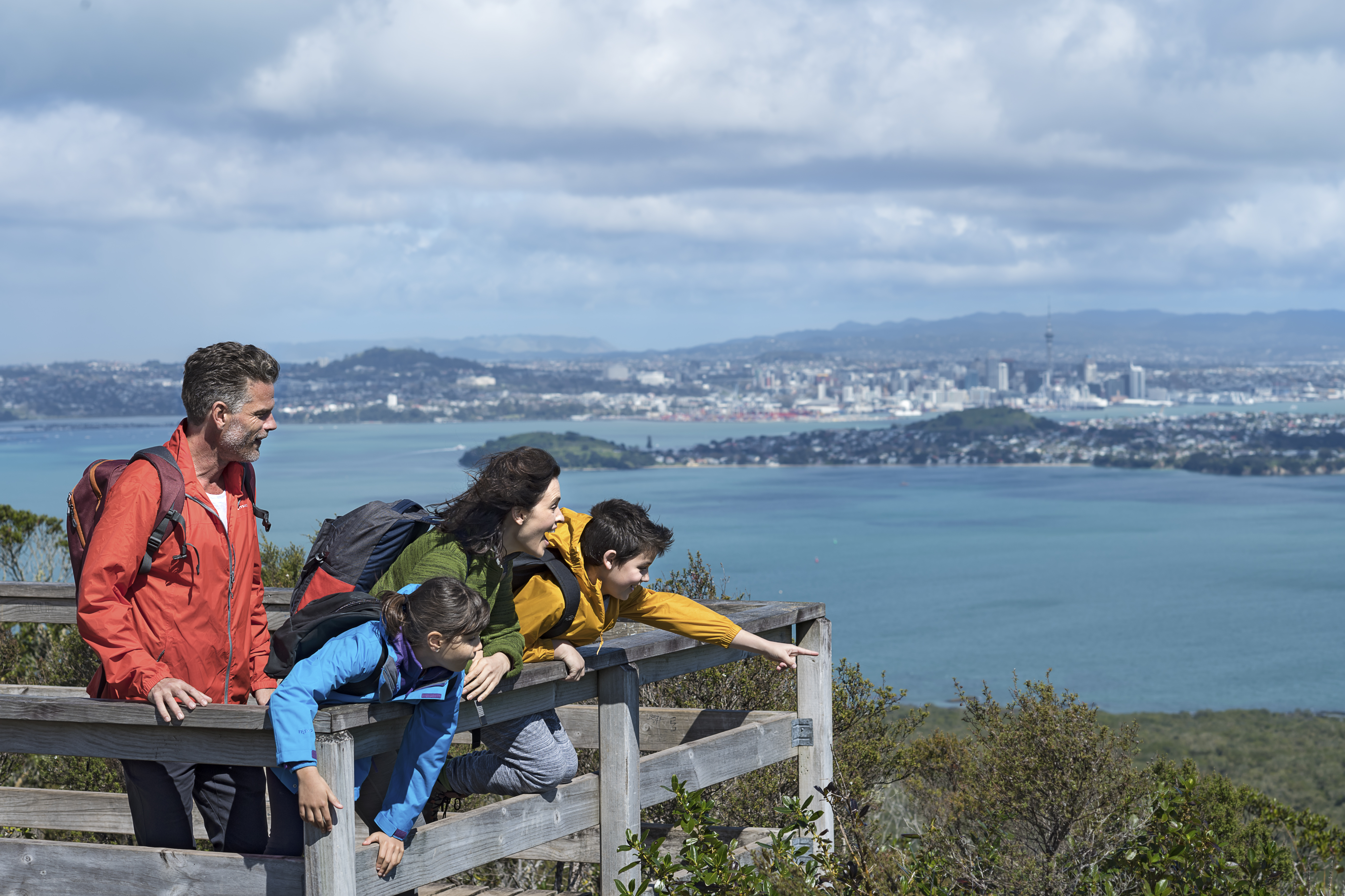
Need a new challenge or want a unique way to explore Auckland? Climb all of Auckland’s Volcanoes, our maunga, to truly be an explore of Tamaki Makaurau.

Our volcanoes – maunga – are one of the things that make our landscape so unique; they also hold huge historical, spiritual and cultural significance to Auckland Māori.

For over 100,000 years Auckland’s volcanoes have been breaking open all over Tamaki Makaurau.

The familiar harbors surrounding Auckland were instead the “Manukau” and “Waitemata” Rivers. Several of the volcanoes which are now harbor inlets (Orakei Basin, Panmure Basin) or islands (Puketutu) actually erupted on to dry land.

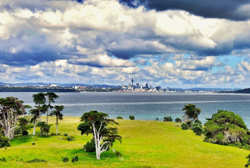
The beautiful parks, reserves and open spaces in just about every suburb of Auckland are a vivid legacy of Auckland’s fiery and explosive past.

Thousands of years ago, a turbulent Auckland Volcanic Field threw up at least 50 cones of varying shapes and sizes, leaving a landscape of hills, valleys and basins. Today, as we walk, drive and cycle around our city, the landscape is a constant reminder of that ancient violent activity.

Pre-European Māori inhabitants of the isthmus saw Auckland’s cones as a wonderful natural asset. They provided defensive positions and refuge in times of danger, and the rich soil was ideal for cultivation. Estimates indicate Auckland supported several thousand residents, living on and around all the hill pā on the isthmus, with kumara plantations covering nearby fertile land.

Later, Pākehā settlers also saw the value of the volcanoes, quarrying the scoria cones and lava flows for material for buildings and civic structures like roads, walls, private and public buildings, and kerbstones – still a familiar feature of Auckland streets.
While some of the volcanoes have been irreparably damaged or even erased completely, most of those remaining are now preserved, and today Aucklanders enjoy easy access to the reserves, parks and walks on these maunga.

As they are important sites of historical, cultural and archaeological significance, visitors should be careful to keep to formed paths and tracks, and to avoid walking on or through sensitive features like the slopes, craters and obvious features, such as historic pits.

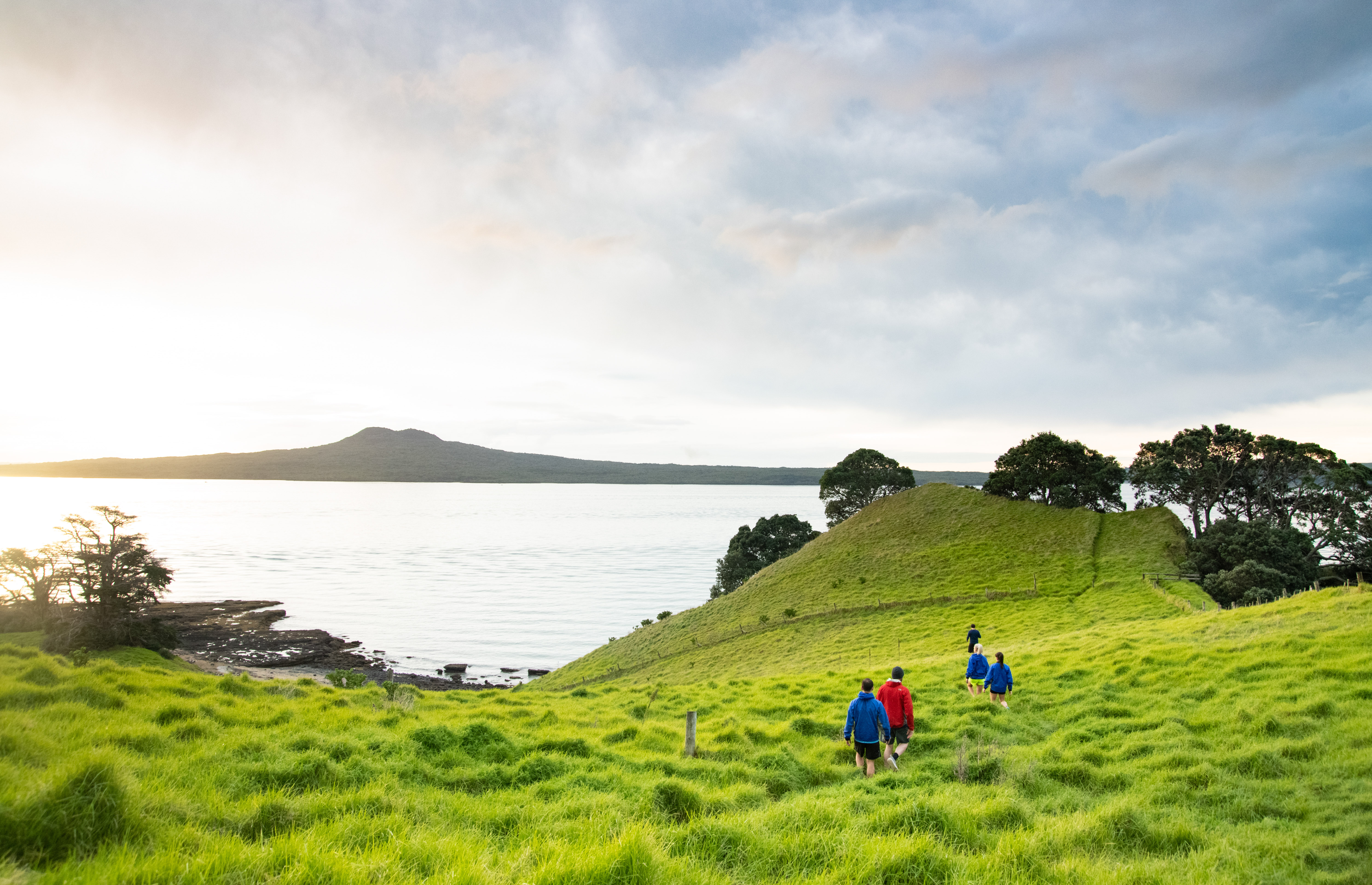
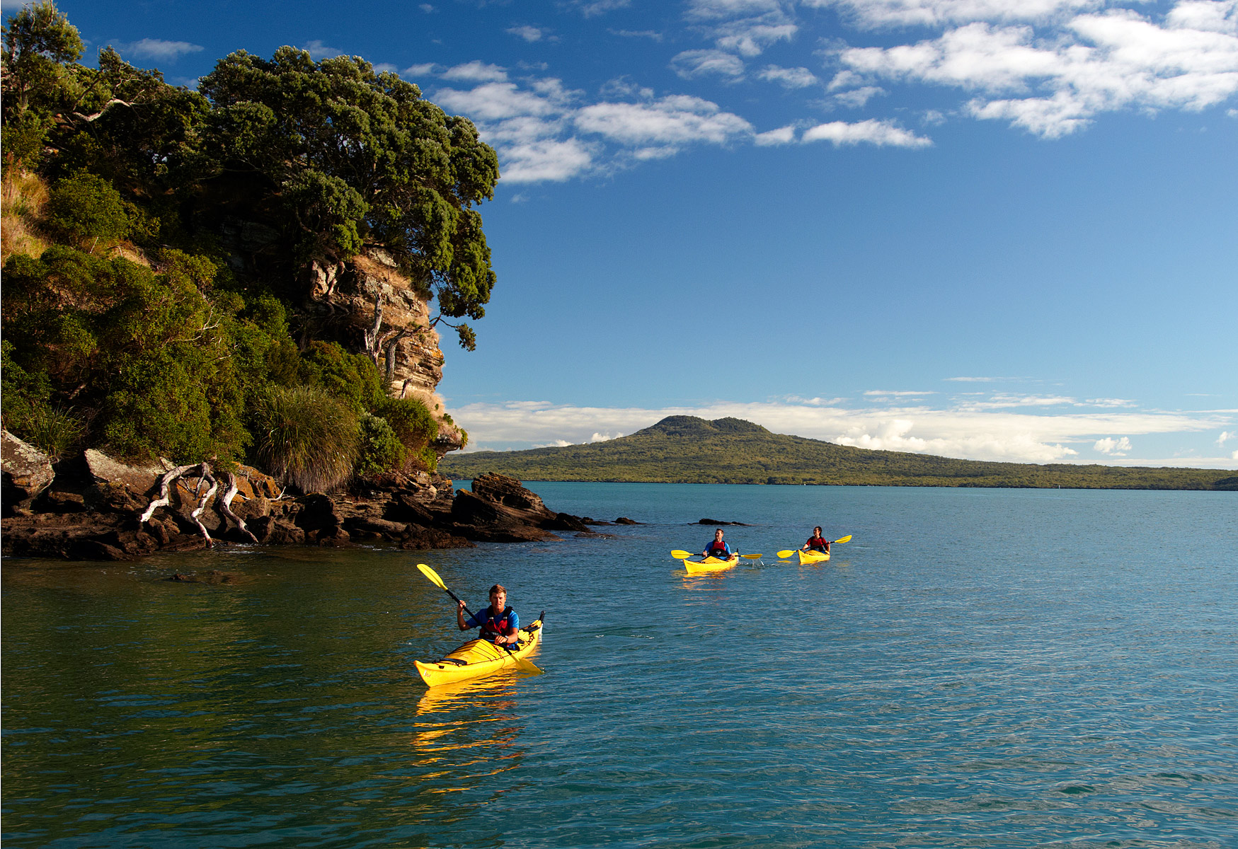
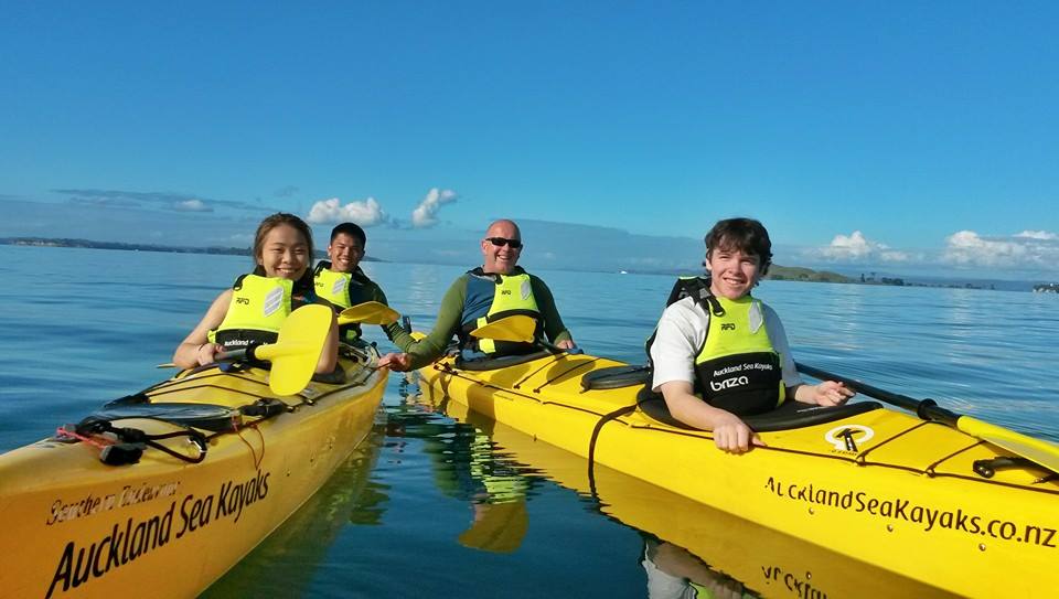
Below is the list of Auckland’s voncaoes. Many can be driven to, some involve a short walk and at least two need to be kayaked to. These being Rangitoto and Motukorea / Browns island.

Volcanoes Age (thousand years) Height Location (Coordinates) Refs Images
Albert Park Volcano 145 Unclear 36.8507°S 174.7675°E [22]  
Ash Hill 30.5 30 metres (98 ft) 37.002754°S 174.867545°E    
Boggust Park Crater 130 5 metres (16 ft) 36.955413°S 174.813552°E [1]  
Cemetery Crater Unknown 33 metres (108 ft) 36.989828°S 174.841082°E [1]  
Crater Hill 30.5   36.986546°S 174.827135°E    
Grafton Volcano 100   36.858440°S 174.763624°E    
Hampton Park Unknown 35 metres (115 ft) 36.950925°S 174.89544°E    
Kohuora 30.5   36.97873°S 174.842691°E    
Mangere Lagoon 50   36.95702°S 174.77763°E    
Matanginui/Green Mount 20 78 metres (256 ft) 36.939911°S 174.898267°E    
Matukutureia/McLaughlins Mountain 50 73 metres (240 ft) 37°00′49″S 174°50′46″E    
Maungakiekie/One Tree Hill 60 182 metres (597 ft) 36°54′0″S 174°46′59″E   One Tree Hill and its obelisk
Maungarahiri/Little Rangitoto 24.5 75 metres (246 ft) 36.875407°S 174.809636°E    
Maungarei/Mount Wellington 10 135 metres (443 ft) 36°53′35″S 174°50′47.6″E    
Maungataketake/Elletts Mountain 90 76 metres (249 ft) 36.994635°S 174.747548°E    
Maungauika/North Head 90 50 metres (160 ft) 36.827751°S 174.81205°E    
Maungawhau/Mount Eden 28 196 metres (643 ft) 36.877°S 174.764°E   Crater of Maungawhau / Mount Eden
Motukorea/Browns Island 24 68 metres (223 ft) 36.8306°S 174.8948°E    
Mount Robertson/Sturges Park 24 78 metres (256 ft) 36.948477°S 174.841726°E    
Ōhinerau / Mount Hobson 34 143 metres (469 ft) 36.877814°S 174.786156°E    
Ohuiarangi/Pigeon Mountain 24.5 55 metres (180 ft) 36.888846°S 174.903116°E    
Orakei Basin 120 Sea level 36.867124°S 174.81308°E    
Otahuhu/Mount Richmond 30 50 metres (160 ft) 36°55′57″S 174°50′22″E    
Ōtuataua 15 64 metres (210 ft) 36°59′10″S 174°45′15″E    
Ōwairaka / Mount Albert 120 135 metres (443 ft) 36.890475°S 174.720097°E    
Puhinui Craters 50 22 metres (72 ft) 37°00′53″S 174°49′59″E [1]  
Pukaki Lagoon 65 Sea Level 36.982998°S 174.810226°E    
Pukeiti 15 30 metres (98 ft) 36.983756°S 174.757183°E    
Pukekawa/Auckland Domain 100   36.859158°S 174.775808°E    
Puketāpapa / Mount Roskill 105 110 metres (360 ft) 36°55′S 174°44′E    
Pukewairiki 130+ 30 metres (98 ft) 36.944078°S 174.865887°E    
Pupuke 190 −57 metres (−187 ft) 36.780115°S 174.766184°E    
Rangitoto Island 0.6 260 metres (850 ft) 36.786742°S 174.860115°E   
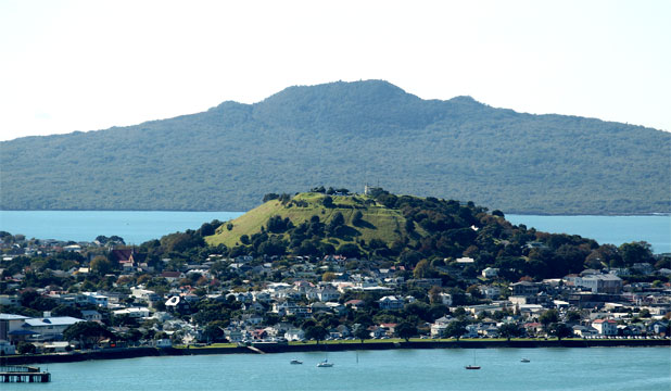
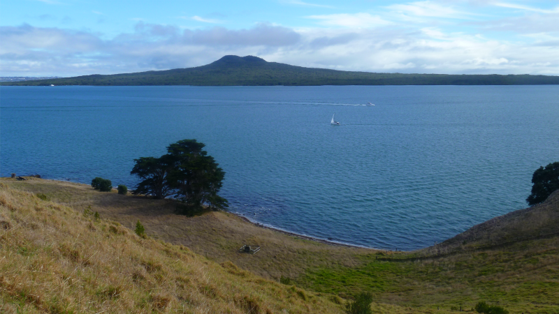
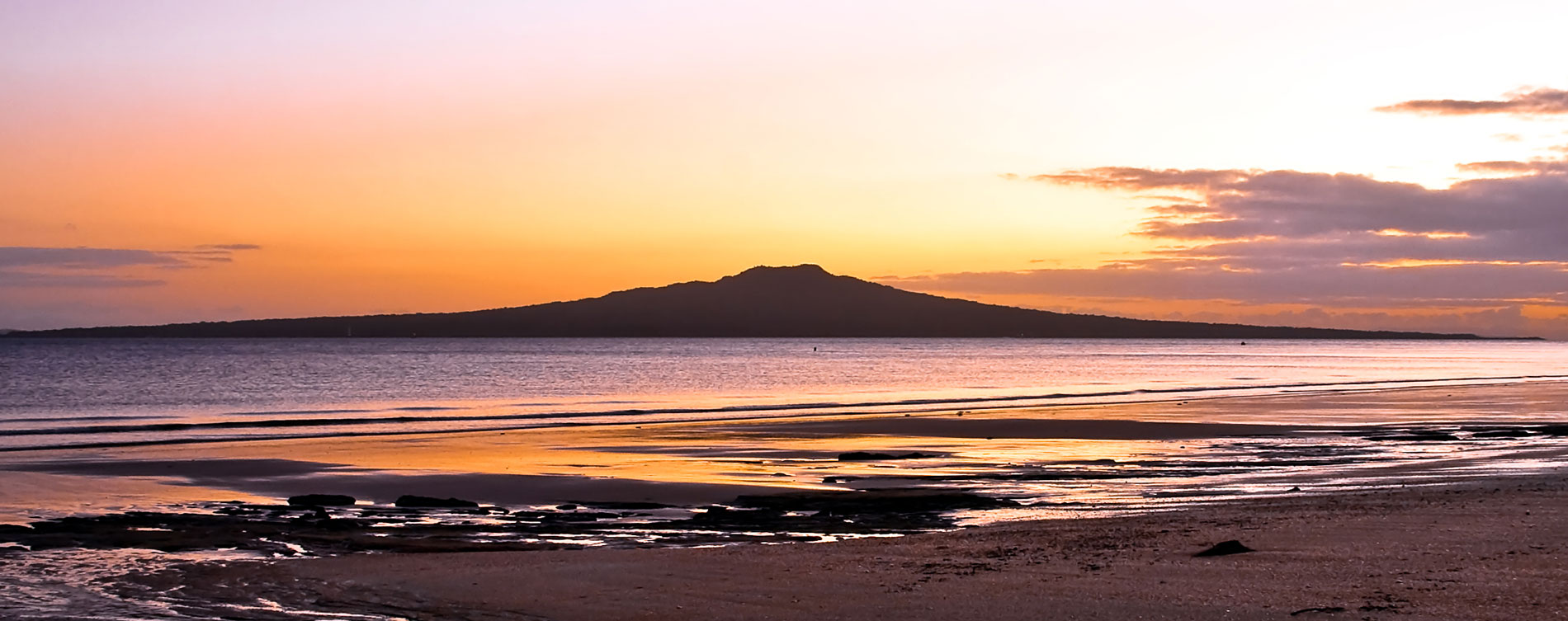
Rangitoto Island on the horizon
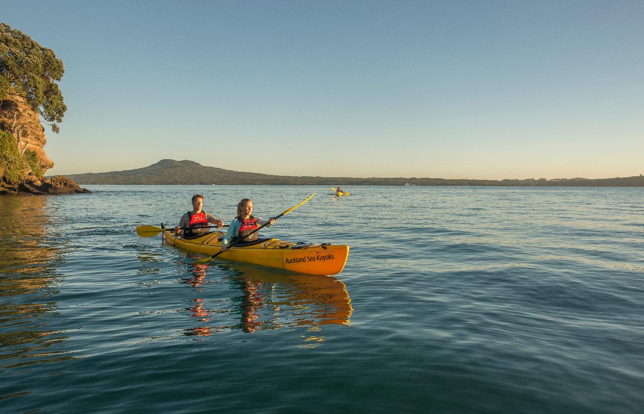
Rarotonga / Mount Smart 20 87 metres (285 ft) (quarried) 36°55′6″S 174°48′45″E    
Styaks Swamp 20   36.936138°S 174.900155°E    
Takaroro / Mount Cambria 40 30 metres (98 ft) (quarried) 36.824444°S 174.801933°E    
Takarunga / Mount Victoria 35 87 metres (285 ft) 36.8266°S 174.7990°E    
Taurere / Taylors Hill 30 56 metres (184 ft) 36.864223°S 174.869943°E    
Te Apunga-o-Tainui / McLennan Hills 41 45 metres (148 ft) (quarried) 36.929208°S 174.846468°E    
Te Hopua-a-Rangi / Gloucester Park 20+ Sea level (reclaimed) 36.9295°S 174.784734°E    
Te Kopua Kai-a-Hiku / Panmure Basin 25 Sea level 36.90495°S 174.849343°E    
Te Kopua-o-Matakamokamo / Tank Farm 180   36.8020°S 174.7533°E    
Onepoto 185   36.80818°S 174.75085°E    
Te Kōpuke / Mount Saint John 75 126 metres (413 ft) 36.883431°S 174.780196°E    
Te Motu-a-Hiaroa/Puketutu 30 65 metres (213 ft) 36.965186°S 174.747248°E    
Te Pane-o-Mataaho/Māngere Mountain 50 106 metres (348 ft) 36.9496°S 174.7831°E [23]  
Te Pou Hawaiki 28 Quarried 36.88247°S 174.766726°E    
Te Puke ō Tara / Otara Hill Unknown 89 metres (292 ft) (quarried) 36.947105°S 174.898363°E    
Te Tātua-a-Riukiuta / Three Kings 28.5 133 metres (436 ft) 36.902926°S 174.754651°E    
Te Tauoma / Purchas Hill 10 50 metres (160 ft) (quarried) 36.887138°S 174.847476°E    
Waitomokia / Mt Gabriel 20.3 20 metres (66 ft) (quarried) 36.976981°S 174.770336°E    
Whakamuhu/Saint Heliers/Glover Park – see Achilles Point 160 Sea level 36.843390°S 174.863800°E    
Wiri Mountain / Matukutūruru 30 80 metres (260 ft) (quarried) 37°00′26″S 174°51′30″E    

OUR PARTNERS

#aucklandseakayaks

Ain't no office better than the Hauraki Gulf 💯☀️
Dinner al fresco. Do the guides deserve a Michelin star? @dukeofednz #dukeofedinburghaward
Team New Zealand @emiratesteamnz training on the Hauraki Gulf yesterday. They tried to keep up with our kayaks but I think they had the wrong foils on 😂
Beautiful jellyfish found on the shoreline at Motukorea. Any marine biologists out there have some intel on this cool creature? @emr_nz
Motunau Bay, Ponui Island. Everyone enjoying an afternoon swim at high tide on the Autumn Equinox, Wed, 20 Mar 2024.
For our tinier Auckland Sea Kayaks whanau | here's an epic colouring in sheet to celebrate Te Ika o te Tau - Fish of the Year competition! Complete this comp and be in to win some amazing prizes including:
- A sunset kayak to Rangitoto for two 
- An eDNA kit or eRangers card game kindly donated by Wilderlab 
- A family pass aboard Perfect Day (NTL) kindly donated by @divetutukaka 
- A mask and snorkel kindly donated by @wettie.spearfishing 
- One of two Marine Invaders card games kindly donated by Marine Invaders 
- A Doon River Fishy Pin kindly donated by @doonriver 
- An @emr_nz  goodie bag, and more!

Tag us and EMR so we can see your masterpieces  #teikaotetau2024 😎
Chloe and Bennett have been going hard at @vectorwero practicing their white water skills. Epic to see their continual progression!
top